
UNIVERSITY PLACE Washington Watercolor City Blocks Map: PRINT
UNIVERSITY PLACE, Washington City Map Art Print. For your Map Wall, memento of your travels, college days or former abodes, reminder of home, gift ...
View full details
 Sale
Sale
UNIVERSITY PLACE, Washington City Map Art Print. For your Map Wall, memento of your travels, college days or former abodes, reminder of home, gift ...
View full details
 Sale
Sale
MOUNT ST. HELENS, Washington - before the 1980 eruption and after. My hand-drawn Map depicts the unique topography of the mountain, after eruption,...
View full details
 Sale
Sale
TAHOMA, Mount Rainier, Washington. This is a PRINT of my hand-drawn topographic map merged with my painting of the mountain in deep blues and a spo...
View full details
 Sale
Sale
Glacier Peak ['Dakobed' / 'Tda-ko-buh-ba' / 'Takobia'] rises above the Mount Baker Snoqualmie National Forest. This view of the most remote of Wash...
View full details
 Sale
Sale
Mount Adams ['Klickitat' / 'Pahto'] rises above the Gifford Pinchot National Forest. This view of the mountain is from the town of Trout Lake. The...
View full details
 Sale
Sale
Mount Baker ['Kulshan'] rises above the city skyline of Bellingham, conveying a sense of scale and relationship. The mountain looms over the North ...
View full details
 Sale
Sale
Mount Rainier ['Tahoma'] rises above the city skyline of Tacoma, conveying a sense of scale and relationship. The mountain looks over us. The "Moun...
View full details
 Sale
Sale
My WHIDBEY ISLAND WA Hand-drawn Topographic Bathymetric Map, now on a Postcard - Show some local love for your favorite island! My sketch of Decep...
View full details
 Sale
Sale
My GIG HARBOR WA Hand-drawn "Blueprint" Map, now on a Postcard - Show some local love for your favorite peninsula harbor town! My hand-drawn ink li...
View full details
 Sale
Sale
My SEATTLE Washington deep-green Watercolor Wash Map, now on a Greeting Card - Show some local love for your favorite city while saying hello! The ...
View full details
 Sale
Sale
REDMOND, Washington Watercolor Wash Map Art Print.For your Map Wall, memento of your travels, reminder of home, signal local-love. Great as a gift ...
View full details
 Sale
Sale
EVERETT, Washington Watercolor Wash Map Art Print.For your Map Wall, memento of your travels, reminder of home, signal local-love. Great as a gift ...
View full details
 Sale
Sale
BREMERTON + Kitsap Peninsula, Washington Map Drawing Art Print. My hand-drawn Topographic Map includes the middle of the Kitsap Peninsula, focused ...
View full details
 Sale
Sale
AUBURN, Washington Watercolor Wash Map Art Print.For your Map Wall, memento of your travels, reminder of home, signal local-love. Great as a gift f...
View full details
 Sale
Sale
EDMONDS, Washington. A generous length of Puget Sound shoreline defines the city of Edmonds - a vibrant community that celebrates history and the ...
View full details
 Sale
Sale
TAHOMA, Mount Rainier, Washington. This is a POSTCARD of my hand-drawn topographic map merged with my painting of the mountain. 18 pt Super Matte C...
View full details
 Sale
Sale
SAN JUAN Islands, Washington. The Map includes all of the San Juan Archipelago in the Salish Sea. A beautiful wonderland of forests and beaches, q...
View full details
 Sale
Sale
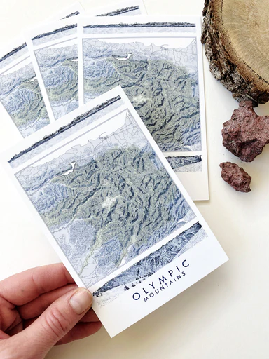
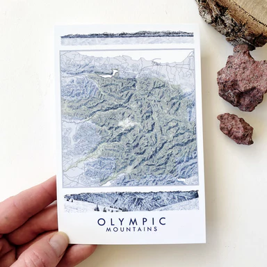
OLYMPIC MOUNTAINS Olympic Peninsula, Washington State Topographical Map Art Prints - Show some local love for your favorite adventure area! This i...
View full details
 Sale
Sale
WHITE CENTER and the southern half of West Seattle, Washington. This is a PRINT. My hand-drawn map lines are turned white over my "Urban Fabric” pa...
View full details
 Sale
Sale
Washington State University, Pullman Washington Campus Map. My hand-painted 16" x 20" Watercolor Map in the crimson color of WSU is a great graduat...
View full details
 Sale
Sale
Washington State University, Pullman. This watercolor map in shades of WSU crimson is a great graduation gift or a special memento for WSU Grads! E...
View full details
 Sold out
TACOMA, Washington. An homage to the peninsula enveloped by the lapping waves of the Sound.This is a MAGNET of my hand-drawn bathymetric lines and...
View full details
 Sale
Sale
SEATTLE, Washington. This is a MAGNET of my original botanical watercolor painting of Ferns from my backyard! A fun way to celebrate your city or ...
View full details
 Sale
Sale
The OLYMPIC Mountains reveal the pileup of shifting tectonic plates at the western coast of the US and create a massive "fortress" between the Paci...
View full details
 Sale
Sale
EDMONDS, Washington. A generous length of Puget Sound shoreline defines the city of Edmonds - a vibrant community that celebrates history and the ...
View full details
 Sale
Sale
EDMONDS, Washington. A generous length of Puget Sound shoreline defines the city of Edmonds - a vibrant community that celebrates history and the ...
View full details
 Sale
Sale
BELLEVUE, Washington. The de facto Seattle suburb is really a whole Place unto itself, offering residents and businesses a great park network woven...
View full details
 Sale
Sale
BAINBRIDGE ISLAND, Washington. A Jewel in the Crown of Islands that punctuate the expanse of the Salish Sea between the Seattle urban corridor and ...
View full details
 Sale
Sale
MERCER ISLAND, Lake Washington. This is a PRINT of my Watercolor Wash Map-drawing in a warm peach/melon watercolor with parks delineated in sage gr...
View full details
 Sale
Sale
BAINBRIDGE ISLAND, Washington. A Jewel in the Crown of Islands that punctuate the expanse of the Salish Sea between the Seattle urban corridor and ...
View full details
 Sale
Sale
BELLINGHAM, Washington. Original Watercolor City Blocks Map. Explore the neighborhoods of Bellingham with your eyes, as the different street grids ...
View full details
 Sale
Sale
BELLINGHAM, Washington. Explore the neighborhoods of Bellingham with your eyes, as the different street grids reconcile themselves to each other an...
View full details
 Sale
Sale
PORT TOWNSEND, Washington.This is a PRINT of my Watercolor Wash Map-drawing in a warm, light peach watercolor with downtown historic district delin...
View full details
 Sale
Sale
BELLEVUE, Washington. The de facto Seattle suburb is really a whole Place unto itself, offering residents and businesses a great park network woven...
View full details
 Sold out
University of Washington, Tacoma ORIGINAL MAP PAINTING. 12" x 16" Unframed. UW-T is nestled in the heart of historic Tacoma, along the Prairie Line...
View full details
 Sale
Sale
SOUTH Puget SOUND, Washington. It's its own Place! (and where I call home ; ) The Map includes the southern end of the Puget Sound and Salish Sea...
View full details
