
DESCHUTES RIVER Oregon Topographic Watercolor Map: PRINT
Oregon’s DESCHUTES RIVER is an conduit for outdoor adventure and a site for making memories. The map centers on the Deschutes River, highlighted wi...
View full details
 Sale
Sale
Oregon’s DESCHUTES RIVER is an conduit for outdoor adventure and a site for making memories. The map centers on the Deschutes River, highlighted wi...
View full details
 Sale
Sale
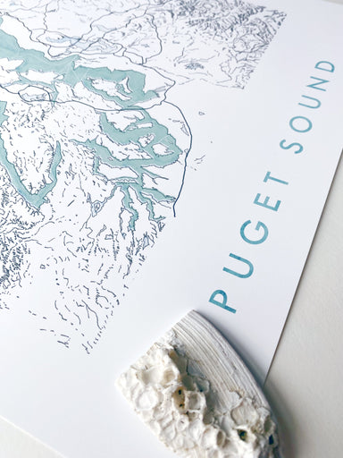
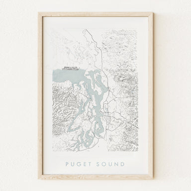
PUGET SOUND, Washington. My hand-drawn Map depicts the Puget Sound, its coastlines, boundaries and islands, ferry routes, and surrounding topograph...
View full details
 Sale
Sale
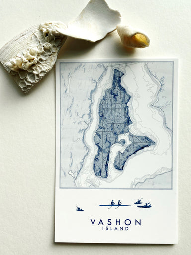
My VASHON WA Hand-drawn Topographic Map, now on a Postcard - Show some local love for your favorite island! My sketch of a vintage ferry boat accen...
View full details
 Sale
Sale
My VASHON WA Hand-drawn Topographic Map, now on a Postcard - Show some local love for your favorite island! My sketch of silhouetted rowers/kayaker...
View full details
 Sale
Sale
TACOMA, Washington Topographic City Map Art Print.For your Map Wall, a memento of home, gift for friends moving, wedding favor.A hand-drawn homage ...
View full details
 Sale
Sale
WY'EAST, or Mount Hood, Oregon. This is a PRINT of my original topographic line drawing, in teal green. Choose a Title: WY'EAST / mount hood, washi...
View full details
 Sale
Sale
WY-EAST, or Mount Hood Oregon. This is a PRINT of my original watercolor painting, in tones of teal and yellow-green- and glacier white. The Timber...
View full details
 Sale
Sale
TAHOMA, or Mount Rainier, Washington. This is a PRINT of my original watercolor painting, in tones of blue-grey and a bit of light blue and sand - ...
View full details
 Sale
Sale
TAHOMA, or Mount Rainier, Washington. This is a PRINT of my original topographic line drawing, in dark blue. Choose a Title: TAHOMA / mount rainier...
View full details
 Sale
Sale
BAINBRIDGE ISLAND, Washington. A Jewel in the Crown of Islands that punctuate the expanse of the Salish Sea between the Seattle urban corridor and ...
View full details
 Sale
Sale
The OLYMPIC Mountains reveal the pileup of shifting tectonic plates at the western coast of the US and create a massive "fortress" between the Paci...
View full details
 Sale
Sale
My WHIDBEY ISLAND WA Hand-drawn Topographic Bathymetric Map, now on a Postcard - Show some local love for your favorite island! My sketch of Decep...
View full details
 Sale
Sale
TAHOMA, Mount Rainier, Washington. This is a PRINT of my hand-drawn topographic map merged with my painting of the mountain in deep blues and a spo...
View full details
 Sale
Sale
MOUNT ST. HELENS, Washington - before the 1980 eruption and after. My hand-drawn Map depicts the unique topography of the mountain, after eruption,...
View full details
 Sale
Sale
MOUNT HOOD, Wy'East, Oregon. For your Map Wall, memento of your climb, reminder of home, spiritual inspiration or adventure aspiration. This is a P...
View full details
 Sale
Sale
MOUNT RAINIER hand-painted Landscape + Hand Drawn Art Map, now on a Magnet - Show some local love for your favorite mountain! This is a METAL MAGN...
View full details
 Sale
Sale
VASHON ISLAND and Maury Island, Washington. For your Map Tree! Or to hang anywhere your need a little map of your favorite place.A fun way to celeb...
View full details
 Sale
Sale
SAN JUAN ISLANDS, Washington. For your Map Tree! Or to hang anywhere your need a little map of your favorite place.A fun way to celebrate your city...
View full details
 Sale
Sale
TAHOMA, Mount Rainier, Washington Topo Map. For your Map Tree! Or to hang anywhere your need a little map of your favorite place.A fun way to celeb...
View full details
 Sale
Sale
My ANACORTES WA Hand-drawn Topographic Map, now on a Postcard - Show some local love for your favorite ferry town! My sketch of the San Juan/Anacor...
View full details
 Sale
Sale
HARSTINE ISLAND, Washington Topographic Bathymetric Map Art Print. For your Map Wall, memento of your Puget Sound adventures, family vacations, rem...
View full details
 Sale
Sale
PUGET SOUND, Washington. My hand-drawn Map depicts the Puget Sound, its coastlines, boundaries and islands, ferry routes, and surrounding topograph...
View full details
 Sale
Sale
KEY PENINSULA, Washington Topographic Bathymetric Map Art Print. For your Map Wall, memento of your Puget Sound adventures, family vacations, remin...
View full details
 Sale
Sale
TUMWATER + Environs, Millersylvania, Mima Mounds, Black Lake, South Olympia, Washington Topographic Bathymetric Map Art Print. For your Map Wall, m...
View full details
 Sale
Sale
ISSAQUAH, Washington Topographic Map Art Print. For your Map Wall, memento of your Cascade adventures, fav hikes, reminder of home. My hand-drawn ...
View full details
 Sale
Sale
LEAVENWORTH, Washington Topographic Map Art Print. For your Map Wall, memento of your Cascade adventures, fav getaway, family vacations, reminder o...
View full details
 Sale
Sale
NORTH OLYMPIA + Environs, Washington Topographic Bathymetric Map Art Print. For your Map Wall, memento of your Puget Sound adventures, family vacat...
View full details
 Sale
Sale
North CASCADES NP + Mount Baker Washington Hand-drawn Topographic Map.For your Map Wall, memento of your North Cascades adventures, reminder of hom...
View full details
 Sale
Sale
HOOD CANAL, Washington Topographic Bathymetric Map Art Print. For your Map Wall, memento of your Puget Sound adventures, family vacations, reminder...
View full details
 Sale
Sale
HARSTINE ISLAND, Washington Topographic Bathymetric Map Art Print.For your Map Wall, memento of your Puget Sound adventures, family vacations, remi...
View full details
 Sale
Sale
VASHON Island and MAURY Island, Washington. Islands in the Sound. For your Map Wall, memento of your adventures, vacation home decor, wedding gift!...
View full details
 Sale
Sale
SAN JUAN ISLANDS Washington Topographic/Bathymetric Map-drawing, now on a Magnet - Show some local love for your favorite magical place! The Map i...
View full details
 Sale
Sale
TAHOMA, or Mount Rainier, Washington Topographic Map + Mountain River Painting Art Print. For your Map Wall, memento of your climb, reminder of hom...
View full details
 Sale
Sale
My LEAVENWORTH WA Hand-drawn Topographic Map + Streetscape Sketch of Front Street, now on a Postcard - Show some local love for your favorite "Bava...
View full details
 Sale
Sale
WY-EAST, or Mount Hood Oregon. This is the Original Watercolor Art Map, composed of hand-drawn topographic contour lines printed onto watercolor pa...
View full details
 Sale
Sale
FALL CITY, Washington. Nestled against the Snoqualmie River and the western edge of the North Cascades, Fall City pays homage to nearby Snoqualmie ...
View full details
